


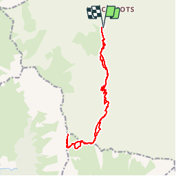


8,2 km | 13,3 km-effort


Utilisateur


Application GPS de randonnée GRATUITE
 SityTrail
IGN / Instituts géographiques
SityTrail World
Le monde est à vous
Randonnée Marche de 15,8 km à découvrir à Auvergne-Rhône-Alpes, Savoie, Les Belleville. Cette randonnée est proposée par tracegps.
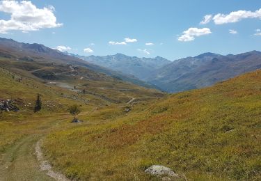
Randonnée de belle envergure mais où vous aurez très probablement comme récompense de pouvoir apercevoir (et c'est peu de le dire) des bouquetins, très nombreux dans ce massif.

Marche

Marche

Marche
Marche
Marche
Marche

Vélo électrique
V.T.T.

Ski de randonnée